Archaeological Screening, Assessment & Testing for the Twinning of Highway 101
In 2008, the Nova Scotia Department of Transportation and Infrastructure Renewal (NSTIR) retained Cultural Resource Management (CRM) Group through Dillon Consulting Limited to undertake archaeological screening and assessment for the twinning of Highway 101 between the communities of Coldbrook and Hortonville, Kings County, Nova Scotia. The study was to address the highway construction corridor (27.5 kilometres long), the footprint of a new interchange and the alignments of six new access roads (totalling more than 11 kilometres).
For the screening, CRM Group combined archival research and field reconnaissance to evaluate archaeological potential. Many areas of high archaeological potential were identified. Each of the areas was subsequently assessed, either by shovel testing or, in the case of active agricultural lands, by visual assessment of freshly ploughed and weathered fields.
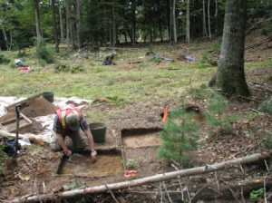
As a result of the shovel testing program, three archaeological sites were identified and registered by the provincial Special Places Program. The Tebraake Site (BgDb-16), subjected to a program of site-specific archival research, was confirmed as the location of a ca. 1920 farm from which buildings were removed in the late 1960s. No further archaeological investigation was warranted. The Ritcey Site (BgDd-2) required the excavation of test units to determine that it was the location of a residence that was occupied briefly and then destroyed by fire in the 1860s. Again, no further archaeological investigation was warranted. The Mijiktook Site (BgDd-3) required the excavation of test units to determine that it was a small Precontact habitation site occupied for a short time during the Late Archaic period, between 5000 and 3800 years ago. When NSTIR was alerted to the age and significance of the Mijiktook Site, it altered plans for access road configuration in order to preserve the site and prevent the need for mitigation.


